Skip to main content
Menu
Contents
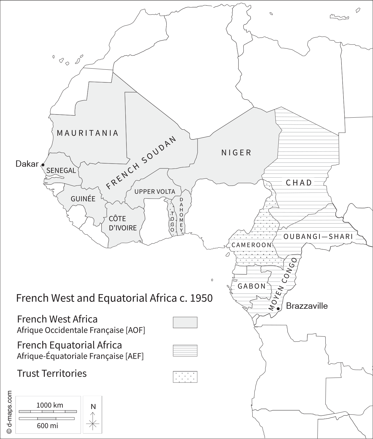
Black France, White Europe: French West and Equatorial Africa c. 1950. Created by Anaïs Faurt (adapted from dmaps.com), 2021.
Black France, White Europe
French West and Equatorial Africa c. 1950. Created by Anaïs Faurt (adapted from dmaps.com), 2021.
Visibility
Show the following:
Annotations
Yours
Others
Your highlights
Resources
Show all
Reader Appearance
Adjust appearance:
Font
Font style
Serif
Sans-serif
Decrease font size
Increase font size
Decrease font size
Increase font size
Color Scheme
Light
Dark
Annotation contrast
abc
Low
abc
High
Margins
Increase text margins
Decrease text margins
Reset to Defaults
Search
Enter search criteria
Execute search
Search within:
chapter
text
project
Sign In
avatar
Edit Profile
Notifications
Privacy
Log Out
Project Home
Black France, White Europe
Projects
Sign In
Learn more about
Manifold
Notes
Close
table of contents
Acknowledgments
List of Abbreviations
Introduction
1. Envisioning France in a Postwar World
2. Recalibrating Laïcité from Brazzaville to Bruges
3. Reconstructing Race in French Africa and Liberated Europe
4. Encountering Diversity in France and “Eurafrica”
5. Forging Global Connections
Epilogue
Bibliography
Index
About This Text
French West and Equatorial Africa c. 1950. Created by Ana
ï
s Faurt (adapted from dmaps.com), 2021.
Annotate
Close
Next Chapter
Introduction
Previous
Next